

Summit Avenue Regional Trail Battle Continues
For almost four years, supporters and opponents have debated the idea of making Summit Avenue’s on-street bike lanes into off-street, protected paths. Both sides presented and debated their views in public meetings and in the media.
For Summit Avenue trail supporters, parking-protected, off-street bike paths have three major benefits:
- They would make a safer, more comfortable bikeway that encourages new or more cautious riders.
- They would create a major east-west route to downtown that can be cleared of snow and ice and used in the winter.
- Moving parked cars next to the driving lanes would shorten crossing distances for pedestrians and make crossing Summit safer. This would hopefully cut down on the number of people that get hit by cars.
Ultimately, based on these and other arguments, supporters of the trail prevailed. Most of the city’s 17 District Councils, the Saint Paul City Council and the Metropolitan Council all overwhelmingly approved what’s become known as the Summit Avenue Regional Trail Plan (SART).
The plan is a basic outline of a one-way, off-street bike path along each side of Summit Avenue. At its core, all it does is to switch the position of the parking lanes and the bike lanes. The parking lanes and curbs are moved inward, next to the driving lanes. The bike lanes are moved outward, up on the newly re-positioned curbs. The trail doesn’t really expand the roadway’s “envelope.” It just switches the position of things. It will also include amenities like raised or “tabled” crosswalks to make the trail smooth across non-signalized intersections, as well as corner curb extensions and possibly a couple of median closures. All these will be geared toward making the trail safer and more comfortable, and improving the safety and comfort of pedestrians crossing Summit.
Now that the basic SART plan is approved, many details have to be figured out, down to how each intersection will look and the exact position and width of different sections of the bike path. Because of street funding problems, it looked like this more detailed planning wouldn’t happen for a decade or more. But the city approved a 1% sales tax increase (“ Common Cent “) last year. This enabled the city to consider Summit and many other street reconstruction projects sooner than originally anticipated.
Despite losing at every political level, opponents of SART have vowed to keep fighting it. The main organization opposing the trail, “Save Our Street” ( SOS) held a meeting July 10 at Cities Church on Summit Avenue. At the meeting, SOS presented the same old bogus arguments against the trail.
These included:
- Huge numbers of trees will be destroyed.
- Parking losses will be catastrophic.
- ADA (Americans With Disabilities Act) access will be diminished.
- Cycling will be degraded.
- Money will be wasted.
- We shouldn’t do this now.
- The “historic character” of Summit will be destroyed, an argument that handily debunked more than two years ago.
They also vowed more lawsuits, and their past public relations manager, Carolyn Will, is running in the upcoming special Ward 4 City Council election on August 12.
In light of all this, it’s a good time to review their objections to a Summit Trail and once again debunk some of the misinformation they continue to spread. Let’s start with tree loss.
‘Trees Will Be Destroyed’
The most important thing to remember with the SART project is this: In most cases, the curbs and storm sewers will be moved inward, away from the trees and toward the roadway. This is true both west and east of Lexington Avenue.
- West of Lexington, on the “A” and “C” sections that have expansive, 90-foot-wide central medians, one curb may be moved outward by as much as 18 inches into the central median on each lane of traffic. But on these same stretches, the parking lanes and outside curbs will be moved inward by 8 to 9 feet, next to the driving lane. The 8 feet that was allocated to on-street bike lanes will be moved outward, up on the newly re-positioned curbs.
- East of Lexington, the curbs will be moved inward by at least 8 feet on each side (over 16 feet total). This includes the existing 5-foot, on-street bike lanes plus one of the existing 8-foot parking lanes. The bike lanes and extra 8 feet from the removed parking lane will be divided and put up on the newly re-positioned curbs to create two, one-way, 8-foot trails on each side of the street.
The bike paths are just asphalt on a crushed gravel base. As such, they are much shallower and have much less impact on tree roots than the roadway they are replacing — and the overall amount of pavement (of any kind) will stay the same.
Given that curbs and storm sewers are being moved inward, away from trees, and the street isn’t being appreciably widened, SART is not going to impact trees. Reconstructing the street, even exactly as it is, might impact trees because their roots sometimes grow around sewer and water lines. But moving the bike lanes to off-street paths won’t destroy trees. Yet SOS claims that the bike path will destroy 950 trees — more than 60% of the trees on Summit.
In early 2022, as news of a street reconstruction and bike trail improvements spread along Summit Avenue, some members of SARPA, the Summit Avenue Residential Preservation Alliance, met to discuss plans to stop it. They formed SOS and organized on the premise that the street’s historic tree canopy would be decimated: not from the construction of new roadbed, not by the replacement of crumbling sewer and water pipes below the frost line, but by the bike trail on top.
To that end, SOS hired an independent arborist, Chad Giblin, to conduct an assessment of portions of Summit Avenue’s boulevard trees. In his report (see “Tree impact on Summit Avenue” under the Resources tab), Giblin looked at 199 trees and speculated what would happen to them if a full street reconstruction were to be completed. Work on his assessment began and ended early in the drafting stages of the SART plan. The authors (Giblin and Manuel Jordan), concluded that, of the roughly 200 trees inspected, 48 would likely experience “significant” impacts that could be mitigated with care after construction, and 83 would experience “severe” impacts, and would be unlikely to recover.
From these data points, SOS extrapolated Giblin’s findings to reach the number 950 (prompting Streets.mn to call it a “disinformation campaign”). But that number does not appear at all in the oft-cited study. Where does the “950” come from? It appears that SOS combined the two figures representing “significant” and “severely” affected specimens, and framed the sum of the two as a percentage of the sample size, totaling over 60% of the trees analyzed. They then extrapolated that percentage to the rest of the 1,561 trees that populate Summit Avenue. Their result is 950, an absurdly high figure.
Aside from the missing 950 number, a few other essential details are present, and absent, from Giblin’s report that undermine SOS’s tree loss claims:
- Bikes. There is no mention of bikes, bicycles, bike paths, trails or anything to do with the central organizing scapegoat of the anticipated Summit Avenue carnage. Giblin’s study focuses entirely on road construction, as opposed to mill and overlay, which he surmises will cause little damage to trees.
- A construction plan. Giblin’s study began and ended before the concept of SART was halfway completed. He lists caveats early in his report, lamenting the lack of a detailed construction plan to look at, a plan that would articulate what methods would be used and exactly where the digger trucks would be operating. Those details emerge much farther along in the process and have yet to be released.
- Lots of assumptions. In the absence of a detailed report, Giblin lists a set of assumptions, based on his knowledge of the city’s general construction practices. The word “assume” is repeated seven times in his report.
- The western half of Summit Avenue. The two sections anticipated to suffer catastrophic loss are both east of Lexington Avenue, the portion of the street lacking a central median as well as a bike buffer zone. This is the more constrained half of Summit Avenue. Extrapolating data from this portion of the street to the more spacious western half stretches credulity.
- An expectation to “bring me back when you know more.” Giblin appeals to his clients to advocate for a “tree preservation ordinance.” If St. Paul had built-in protections to mitigate construction impacts, he suggests, a lot of trees might be saved. And the aforementioned lack of detailed plans means that as the proposal evolves and changes, his assessment might, as well. “Changes to the scope of proposed construction activities and/or tree preservation measures … will result in a need to perform a new analysis to update results,” he says.
So SOS’s commissioned tree loss report doesn’t really say what the group wants it to say. And, when it comes to a tree preservation ordinance, the city recently proposed one and SOS doesn’t like it.
Co-author Ed Steinhauer reached out to Carolyn Will, SOS’s then-communications director, and asked if the group would support the reconstruction of Summit Avenue if the bike plan was no longer a part of it.
“Not without a comprehensive tree ordinance,” she responded.
“OK,” he asked her, “if one were to be passed, would you support it then?”
“Only if it were proven to be necessary.”
This was two years ago. In January of this year, an email blast went out to SOS members announcing that indeed, St. Paul was working on a citywide tree preservation ordinance, with a vote scheduled for February. SOS was caught flat-footed, and it wanted “in.” They arranged a meeting with Ward 2 City Councilmember Rebecca Noecker (now council president), who outlined the city’s plan to stipulate that when construction required tree removal, they would be replaced 1:1. That wasn’t good enough. SOS wanted a higher ratio of tree replacement and stronger enforcement measures than what was outlined in the city’s plan.
The council voted to table the proposal for six months. In the intervening time, they would convene an “informal tree preservation advisory group,” composed largely of members from both SOS and SARPA. A final vote in the City Council will be conducted on August 27.
By contrast, the city gave a presentation on the SART plan in late February 2023. Members of the Parks and Recreation department were there, and so was Sean Kershaw, director of Public Works. He insisted that whatever damage would befall Summit’s tree canopy would be from the reconstruction project and not the bike paths. “Whether this project had the element of a bike path or not,” Kershaw stated, “the effect on trees would be the same.” Based on past street reconstruction projects, the city estimates that 221 trees could be compromised (roughly 14% of the total). See page 121 of the Summit Regional Trail plan as well as a bulleted list of construction practices before, during, and after street construction on p. 181.
Gary Todd, the head of SOS, recently submitted testimony to the City of St. Paul, arguing against the use of 1% sales tax money to fund reconstruction of Summit Avenue. He also submitted documents indicating that, contrary to the conventional wisdom, portions of the first sections of Summit scheduled for reconstruction had in fact been rebuilt in 1978 and 1979. This begged the question: If a few portions of Summit have already been rebuilt west of Hamline, how old are the trees there? Were they devastated by the 1979 reconstruction?
We were curious to find out. So, measuring tape in hand, we looked at the trees west of Hamline in areas with newer curbs, to see if they seemed substantially different or smaller than trees in other sections. The answer was “No.” In areas with newer looking curbs, we saw many basswoods, hackberry, catalpa, maples and other trees that appear to be between 50 and 100 years old.
The tree apocalypse predicted by SOS as part of any street reconstruction didn’t happen in 1978 and ’79. And if the Summit Avenue Regional Trail is implemented, it won’t happen now.
‘Catastrophic’ Parking Loss
No parking will be lost west of Lexington (over half the project area). East of Lexington, the SART Plan would remove half the existing parking.
The city did parking utilization studies of Summit and some adjacent streets in 2019 and 2022 to determine how much of the existing on-street parking was actually used. These studies are referenced on page 95 and in the appendix pages 224–233 of the SART plan. With the exception of a two-block stretch around Dale Street, the studies found “parking utilization rates well below 50%” along most of Summit. So removing half of the parking east of Lexington will not pose an undue burden on motor vehicle owners. With the two blocks around Dale Street, excess parking capacity exists on side streets or two blocks away on Summit itself. Also, some kind of permit system could be added to this specific area if parking there becomes a long-term problem.
East of Lexington, in an effort to mitigate complaints about which side of the street would lose parking, an earlier draft of the SART plan proposed to chicane the street. This means the travel lanes would move slightly from side to side over the course of a block or two, so one side of the street could have parking on some blocks and the other side of the street could have parking on other blocks.
The city currently does this on Western Avenue, between Marshall and Concordia and along much of University Avenue, and no one notices. Yet SOS claims this proposal will “destroy Summit.” Alas, it’s just a proposal. If SOS wants to keep parking on just one side of the street, east of Lexington, I’m sure trail supporters would be fine with that.
Diminished ADA Access?
This is a baffling claim by SOS. Somehow, having a paved path next to the passenger side of parked cars will diminish access for people with disabilities.
Currently, on the passenger side of parked cars is just grass and mud in the summer or ice and snow in the winter. Neither of these seem particularly wheel-chair accessible or helpful for people with walkers or other mobility devices. So having a paved bike trail here would seem like a huge boon for folks with mobility issues.
Wheelchair lifts could set someone down right onto a paved path wherever they parked. Plus, the SART project will be adding “bump-outs” (curb extensions) and ADA ramps at every corner and adding elevated/tabled crosswalks at all non-signalized cross streets, meaning folks won’t have to step down to cross the street.
Because the city has committed to plow the proposed trails, they will also be usable for mobility-impaired folks in the winter. Currently many sidewalks aren’t shoveled, so this will be a huge improvement. Thus, by every measure, SART would improve ADA access, not diminish it.
The only argument SOS could come up with for why ADA access would be diminished was “e-bikes will be going very fast and will hit disabled people.”
‘Cycling Will Be Degraded’
According to SOS, e-bikes make building off-street, protected bikeways impossible. Yet, off-street paths exist throughout the Twin Cities and all over the world — and speeding e-bikes are no more hazardous on these paths than they are in bike lanes. Same with recreational speed cyclists.
SOS also seems to have an ideological hatred of off-street paths. Several of its members are devotees of John Forester, the late author of a book called “Effective Cycling,” who believed that bikes belong in the street with cars. He was briefly head of the League of American Bicyclists in the early 1980s and influenced U.S. bikeway design policy away from separated paths. Yet, based on his preference for on-street bike lanes, bicycle mode share in most U.S. cities is still stuck at 5% to 6%. Whereas Holland and countries that went for off-street, protected paths have bicycle mode share rates as high as 38%. Even Helsinki, a city with similar weather to St. Paul’s, has a bicycle mode share of 11% of all trips.
The conflicts between advocates for John Forester’s “vehicular cycling” approach, and the growing preference for separated trail facilities, has an interesting analog to another influential thinker named Roger Gellar, a bike planner for the City of Portland, Oregon.
Geller wrote an influential paper outlining the “ Four types of cyclists, “ based on extensive surveys of people’s attitudes about bicycling.
- On one end of a continuum are “strong and fearless” riders, who do not need any kind of bike infrastructure to feel comfortable. Like the Forester devotees, they prefer not to use dedicated bike lanes. This category amounts to less than 1% of the general population.
- On the other end of the spectrum are people who are “no way, no how” and would prefer to avoid cycling altogether. They account for 33% of people.
- “Enthused and confident” riders are the most comfortable riding under a variety of circumstances but will seek out the best available options. Those amount to 7% of the public.
- But the biggest category by far are the “curious but cautious” group, who are not opposed to cycling for transportation but will use only the safest possible options. This group accounts for 60% of the general population.
These categories have been borne out in peer-reviewed studies across the country and vary within just a few percentage points from city to city. The study appears in a full-page spread in St. Paul’s revised 2024 Bicycle Plan, on page 26. The Summit Avenue Regional Trail plan is designed to appeal to these latter groups, especially those who are “curious but cautious.”
Based on Forester and bogus data, SOS members claim that off-street paths are less safe than on-street bike lanes, particularly on streets with lots of intersections. But SOS conflates data on two-way bike paths with one-way paths of the type proposed on Summit. One-way paths are as safe or safer than in-street bike lanes and extensively used throughout the United States, around the world and even in the Twin Cities. If we were to base street design strictly on John Forester’s ideas, we’d be putting pedestrians in the street with cars.
Recreational speed cyclists might be slowed down by the new SART trails but, if we keep the paths to a minimum of 8 feet in width, faster cyclists should have plenty of room to pass slower ones.
‘Money Will Be Wasted
SOS claims building SART is a huge waste of money. But, at some point, money is going to be spent redoing Summit Avenue. Some day, the street, curbs, gutters, storm sewer lines, sanitary sewer lines, water lines and probably many home connections to these lines will all be replaced as part of a full street reconstruction.
When the street is put back, it’s not going to cost a lot extra to put it back in a different configuration than it currently is, with parked cars next to the driving lanes and bikes up on newly re-positioned curbs. It would be vastly more wasteful to try to change the configuration of the bike lanes after the street is reconstructed. Most of the estimated costs for reconstructing the first two sections of Summit would be the same whether it was constructed as-is or based on the SART Plan.
‘We Shouldn’t Do This Now’
SOS argues that Summit shouldn’t be reconstructed “now” (meaning in the next 10 or 15 years), that the city has bigger needs. In fact, SOS argues, Summit shouldn’t be reconstructed at all, even if it were put back exactly the way it is! The group claims that two sections west of Hamline Avenue were redone in 1978 and 1979, and trail opponents claim the network of sewers and storm drains can be replaced via “horizontal” or “trenchless drilling” techniques that obviate the need to tear up the street.
Trenchless lining or pipe-bursting techniques can be significantly more expensive and are unsuitable for many situations. If a section of sewer pipe is pitched wrong or has become severely misaligned (due to sinking), trenchless methods can’t fix that. Trenchless can’t fix major obstructions like large tree roots or majorly collapsed pipe. Also, pipe-bursting can cause damage to adjacent utilities and can’t be used in rocky soils or with reinforced concrete pipe. SOS cited a sewer line in some southeastern U.S. city that was done with trenchless drilling. But folks at Public Works investigated and found it was a completely different situation and not feasible for Summit.
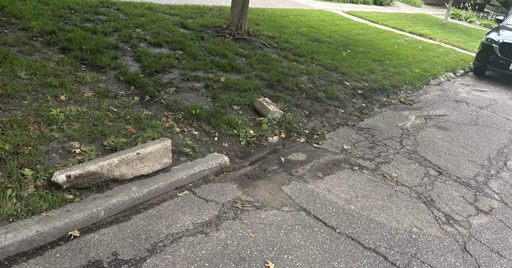
The city acknowledges that sections of Summit east of Hamline Avenue were partially reconstructed 50 years ago, one between Hamline and Snelling and another on the north side of one block, in front of the University of St. Thomas. Regardless, the pavement, curbs and gutters for this half of Summit are in horrible condition, particularly west of Snelling Avenue. In many places the curbs are entirely missing, and dirt from the medians washes into the street.
East of Lexington, the newest stretch of Summit was last fully reconstructed in 1917. Many of the water lines in this stretch are cast iron or lead. The city points out that pavement condition for parts of both east and west Summit are terrible, and there are issues with standing water and drainage.
City officials argue that street reconstructions shouldn’t wait until a sewer fails or a giant sink hole opens up in the middle of the street, like recently happened on West Seventh Street. Responding on an emergency basis is more difficult and expensive than making improvements in a preemptive, planned way.
Large portions of Summit Avenue clearly are beyond just “mill and overlay.” In many places, the current road surface is higher than the curbs and curbs are decaying or nonexistent. Recent asphalt “skim coatings” or mill and overlays are already cracking and falling apart because the roadbed underneath them is no longer stable. The bike lanes are particularly bad. Allowing the street to rot is not an acceptable solution.
‘Historic Character’
SOS claims that changing the bikeway will destroy Summit’s historic character, but this depends on which era of history you wish to return to.
- We could go back to when the street was made of dirt and had horses and carriages, or when it carried more bicycles than cars, at the height of the 1880s and ’90s bicycle craze.
- Or we could go back to when there was no parking on many sections of Summit and it carried four lanes of traffic, much like Lexington Avenue does today.
- Dan Marshall wrote an excellent piece debunking some of SOS’s historical claims.
Finally, SOS claims that “as many as 14 median crossings could be closed.” The group ties this to its historical claims but also says it “would impede emergency vehicles.”
In fact, only 14 median openings are at unsignalized intersections on the entire street. So SOS is claiming that SART proposes closing all of them. This is ridiculous. On pages 147 and 148, the plan proposes closing up to three of them (at Prior, Finn and a non-intersection right before Mississippi River Boulevard), but not all 14.
And SOS’s claim that “it would impede emergency vehicles” is a claim used used by opponents of traffic-calming proposals throughout U.S. history. It has been thoroughly debunked.
The Future of SART
In summary, the arguments of Save Our Streets and other trail opponents don’t hold up. They didn’t hold up in hearings before the city and the Met Council voted to approve the project, and they don’t hold up now. But opponents have free legal representation via their lawyer, Bob Cattanach, and they have a PR person, Carolyn Will, who is now running for Ward 4 City Council. They also have a lot of money and are continuing to fundraise to finance their legal and lobbying efforts.
Their strategy going forward is to slow down the trail or stop it via lawsuits and to elect trail opponents like Will to the City Council in the hopes that they can muster four votes to repeal approval for the trail. They are also talking about fronting a candidate for mayor to defeat Melvin Carter.
Public Works has placed two sections of Summit on its 5-Year Capital Improvement Program. The department is proposing to redo the section of Summit from Mississippi River Boulevard to Fairview Avenue in 2028 and from Fairview to Hamline avenues in 2029.
In order to do this, the city will spend about $3.5 million beginning in 2026 to do detailed planning for the entire street, including public outreach, and an Environmental Assessment Worksheet (EAW) for the entire SART project. This is something SOS demanded and an added layer of expense. The city has rarely done EAWs for street reconstructions, even for projects that included major changes to streets like Wheelock Parkway, Johnson Parkway and Como Avenue. But they’re doing an EAW now.
Whether the Summit Avenue Regional Trail will ever get built may be determined by the upcoming Ward 4 City Council election or by the courts. We should know more in the next two years. In the meantime, there’s still work to be done if we want to ensure that this important project happens.
